

Severe Thunderstorm Warning SEVERE THUNDERSTORM WARNING - Pima County

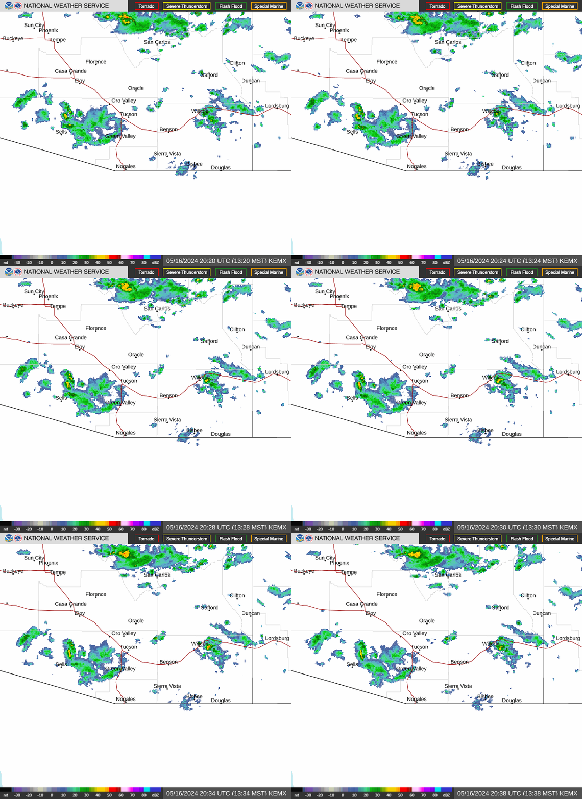
NWS Tucson, Arizona Regional Radar WU South West Satellite
Radar/Satellite images courtesy of NOAA/NWS and Weather Underground.
spacer
Updated: @ 22-Oct-2026 4:36pm - next update at 12:00am   updated
Summary / Temperature Wind Rain Cloud Height
mostly clear -  Lightning observed mostly clear - Lightning observed
Currently: 82.5, Max: 91.2, Min: 71.7 82.5°F
Temp Trend Colder 4.1°F than last hour.

---

Feels like: 91.2°F

24-hr difference
-7.4°FColder 7.4°F than yesterday at this time.
  Today Yesterday
High: 91.2°F
1:48pm
92°F
2:59pm
Low: 71.7°F
7:03am
69.3°F
5:14am
Fire
Davis VP2 Status
ICN:9 | ISS:Ok | CON:4.7 | RCP:99%
Indoor Temp and Humidity
Indoor Temp: 83.7°F
Indoor Humidity: 44 %
 Wind from SW SW
5.8
Gust:
6 mph
2 Bft - Light Breeze
Max Gust: 15 mph  1:22 PM
1Hr Average: 6 mph
Max Gust
This Month:
27.0 mph
on  Oct 10
Wind Run: 25.88 miles
Wind Year: 10621.99 miles
Rain Today: 0 in
Rain Rate (/hr): 0 in
Rain Yesterday: 0 in
Storm Rain: 0 in
This Month: 0.53 in
Season Total: 9.95 in
Last Rain
Time/Date:
10/20/2026
at 4:28 PM
52 rain days in 2026
7 rain days in October
Humidity & Barometer Almanac Sun/Moon
Humidity: 49 % Increased 4.0% since last hour.
High Humidity
Today:
76%
at 3:57 AM
Low Humidity
Today:
37%
at 1:39 PM
Barometer: 29.727 inHg Rising 0.01  inHg/hr
Baro Trend: Steady
Dew Point: 61.4°F Decreased 1.4°F since last hour.
Wet Bulb: 69.3
Sunrise: 6:33am
Sunset: 5:44pm
Moonset: 2:54am
Moonrise: 3:45pm
Full Moon: Sun, 25-Oct-2026 9:12pm MST
New moon: Mon, 09-Nov-2026 12:03am MST
Sunlight:
Today:11 h 10 m 15 s
(Noon)
graph
(Midnight)
Waxing Gibbous
Waxing Gibbous, Moon at 11 days in cycle
86%
Illuminated
Current UV Index Current Solar Energy Air Quality
0.0
Sunburn in
720 Minutes
Highest:
12:14 PM
7.7
179 W/m2
96 %
W/m2 ⇒ SI
Highest:
1:27 PM
993
45
  Good
Averages / Records
Average Temperatures This Date Record Temperatures This Date
Average High
85°F
Average Low
57°F
Record High
96°F (2016 & 2024)
Record Low
29°F (1908)
 NWS Weather Forecast  - Outlook: This Afternoon & Tonight
This
Afternoon
This Afternoon: Chance Showers And Thunderstorms
Chance Showers And T-Storms

Hi 83 °F
NWS forecast: A chance of showers and thunderstorms. Partly sunny. High near 83, with temperatures falling to around 78 in the afternoon. Southwest wind around 12 mph, with gusts as high as 21 mph. Chance of precipitation is 30%.
Davis VP+ forecast: Mostly clear. Cooler. Lows 54 to 59. Southwest wind around 10 mph.
 
Tonight

Tonight: Mostly Clear
Mostly Clear

Lo 58 °F
NWS forecast: Mostly clear, with a low around 58. North northwest wind 2 to 9 mph.
NWS Short Term Weather Forecast
Friday

Friday: Sunny
Sunny

Hi 77 °F
Friday
Night
Friday Night: Mostly Clear
Mostly Clear

Lo 56 °F
Saturday

Saturday: Sunny
Sunny

Hi 76 °F
Saturday
Night
Saturday Night: Mostly Clear
Mostly Clear

Lo 56 °F
Sunday

Sunday: Sunny
Sunny

Hi 78 °F
Sunday
Night
Sunday Night: Mostly Clear
Mostly Clear

Lo 56 °F
Monday

Monday: Sunny
Sunny

Hi 80 °F
Animated icons courtesy of www.meteotreviglio.com.